Electric Vehicles
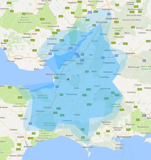
Range Map: Full charge: return trip range
|
Example
Range map for a day trip, there and back, from cottage on a single full charge. Based on 28kWh nominal battery capacity (which is quite modest these days). Real world driving, but this can be reduced by driving style, sustained speeds greater than 75mph and in winter. Darker blue: standard drive setting Lighter blue: eco drive setting |
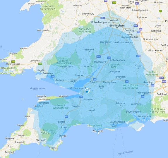
Range Map: Full charge: maximum range
|
Example
Range map for a single, outbound only, journey from cottage on a single full charge. Based on 28kWh nominal battery capacity (which is quite modest these days). Real world driving, but this can be reduced by driving style, sustained speeds greater than 75mph and in winter. Darker blue: standard drive setting Lighter blue: eco drive setting |
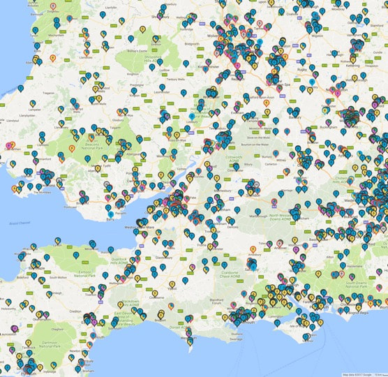
Regional Charging Point Map (c/o Zap-Map)
|
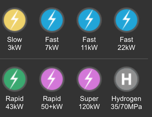
Each marker is a single or multiple charge point location. Colour legend below. Dual or triple coloured markers indicate multiple types of charger. A red outline indicates "in use" or "not working"
This image courtesy of Zap-Map a free-to-use website and app that gives one of the fullest maps of UK charging points. The map can be filtered by connector type or power, or by vehicle-type. Each marker can be clicked for more information, tariff details (many are free to use) and live comments from users their experience with that charge point. |

